
What Documents Does a Licensed Surveyor Review Before Starting a Survey?
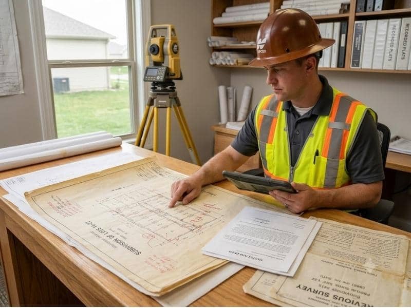
Most people think a survey starts when someone shows up with equipment and walks the yard. But a licensed surveyor does a lot of important work before ever setting foot on the property. That work happens in records offices, online databases, and file cabinets, and it shapes everything that follows in the field.
Every Survey Starts With Good Records
A property boundary isn’t something a surveyor invents. It comes from a chain of legal documents that goes back to when the land was first divided and recorded. Before a surveyor can locate a boundary on the ground, they need to understand what those documents say.
Skipping this step would be like trying to build something without reading the plans first. The records tell the surveyor what the boundary is supposed to look like. The field work confirms whether the ground matches that description. One without the other leaves too much room for error.
This research phase also helps the surveyor spot problems early. If two documents contradict each other, or if a recorded description doesn’t match a recorded map, those are issues that need to be worked out before any measurements are taken outside.
Deeds Help Show Property Boundaries
The property deed is usually the first document a licensed surveyor looks at. A deed is the legal record of ownership for a piece of land, and it often includes a written description of the property’s boundaries.
That written description, called a legal description, spells out the shape and size of the lot using measurements, directions, and reference points. Some legal descriptions are simple and easy to follow. Others are old, written in language that takes experience to interpret correctly.
A surveyor reads the legal description carefully to understand what the boundary is supposed to be. They also look at how the deed connects to surrounding properties, because a boundary on one side of a lot is also the boundary of the lot next to it. Understanding how the pieces fit together helps the surveyor build an accurate picture before any field work begins.
Old Maps Can Fill in Missing Details
Deeds don’t always tell the whole story. That’s why a licensed surveyor also looks at plat maps, older surveys, and public records that cover the same area.
A plat map is a recorded drawing that shows how a piece of land was divided into individual lots. It usually includes lot dimensions, street layouts, and the locations of easements or setbacks. When a property is part of a recorded subdivision, the plat map is one of the most useful documents a surveyor can review.
Older surveys of the same property are valuable too. A previous survey might show where corner markers were placed years ago, which gives the current surveyor a starting point for locating them in the field. Even if the markers have shifted or disappeared, knowing where they were supposed to be helps narrow the search.
Public records from the county, such as recorded easements, right-of-way documents, and utility agreements, round out the picture. These records can reveal restrictions or boundary adjustments that don’t show up in the deed alone.
The Land Must Match the Records
Once the document research is done, the licensed surveyor takes that information into the field and starts comparing it to what’s actually on the ground.
This is where things get interesting. Sometimes the land matches the records almost perfectly. The corner markers are where they should be, the dimensions check out, and the boundary lines are easy to confirm. Other times, the field work turns up something that doesn’t match. A fence sits several feet away from where the legal description puts the line. A marker is missing or clearly moved. A neighbor’s structure sits closer to the boundary than the recorded easement allows.
When the field findings don’t match the documents, the surveyor has to figure out why. That might mean going back to pull additional records, researching the history of a specific marker, or reviewing how nearby properties were surveyed in the past. The goal is always to reconcile what the records say with what the ground shows, using professional judgment and legal standards to reach the correct answer.
Good Research Helps Avoid Mistakes
The document review phase isn’t just preparation. It’s one of the most important parts of the entire survey process.
A licensed surveyor who skips thorough research is more likely to miss a boundary conflict, misread a legal description, or place a marker in the wrong spot. Those mistakes have real consequences. A fence built on a bad survey can end up over the property line. A building permitted on faulty boundary information can create legal problems for the owner years later.
Good research makes the field work more efficient too. When a surveyor arrives on site knowing what to look for and where to look for it, the job moves faster and produces better results. The time spent in records before the visit saves time, and money, once the work begins outside.
Frequently Asked Questions
What records does a licensed surveyor need?
A licensed surveyor typically reviews the property deed, any recorded plat maps, previous surveys of the property, and public records from the county such as easements and right-of-way documents. The specific records needed can vary based on the property’s history and location.
Do I need to give the surveyor my deed?
It helps to share any documents you have, including your deed and any previous surveys. A licensed surveyor can also pull many records independently through county offices and public databases, but having your documents on hand can speed up the research phase.
Can a licensed surveyor use an old survey?
Yes. An older survey of the same property can be a useful reference, especially for locating where corner markers were originally placed. The surveyor will verify whether that information still holds up by comparing it to current records and field conditions before relying on it.
What is a property plat map?
A plat map is a recorded drawing that shows how land was divided into individual lots. It typically includes lot dimensions, street layouts, and the locations of easements or other recorded restrictions. Plat maps are especially useful for properties in recorded subdivisions.
Why does a surveyor check county records?
County records contain important information that may not appear in a property deed alone. Recorded easements, utility agreements, right-of-way documents, and boundary adjustments are all kept at the county level. Reviewing these records helps the surveyor get a complete picture of the property before field work begins.
How long does it take to review survey documents?
The time needed depends on the complexity of the property and how far back the records go. A straightforward residential lot in a recorded subdivision may require only a few hours of research. A property with a long history, multiple deed transfers, or unresolved boundary questions can take significantly longer to research before field work begins.