
How LiDAR Mapping and Topographic Surveys Work Together
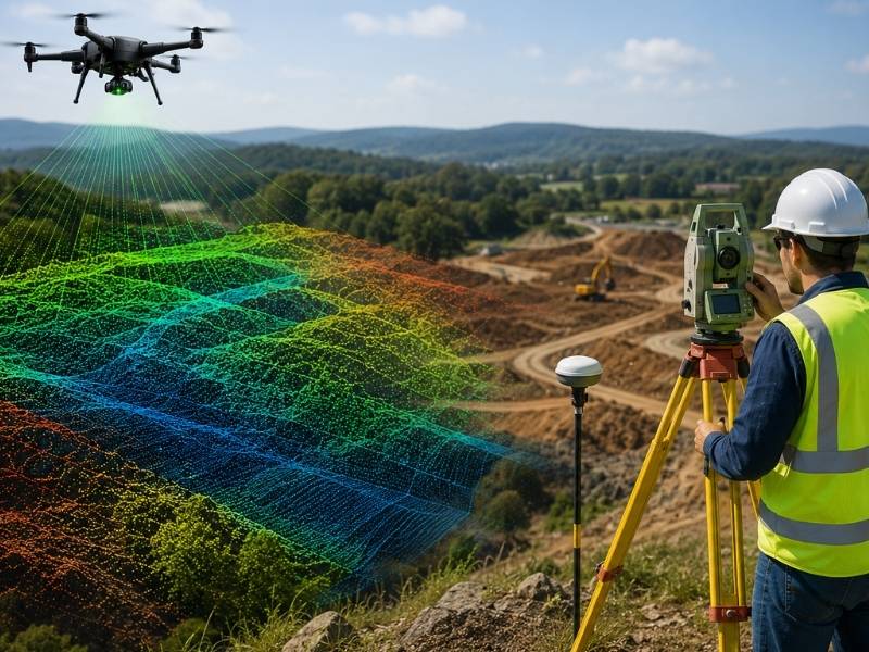
LiDAR mapping and topographic surveys aren’t competing tools. They work best as a team. Developers sometimes think they have to pick one or the other. That’s the wrong question. The real value shows up when both methods feed into the same site plan.
Here’s how these two tools combine, and why the pairing matters for site planning accuracy.
How LiDAR Point Clouds Add Detail Between Topographic Survey Shots
A traditional topographic survey collects data at specific points. A crew walks the site and takes readings at chosen spots. That gives accurate numbers, but only at those exact locations. Everything between those points gets filled in by estimation.
LiDAR works differently. It scans the whole surface and creates a dense point cloud, often millions of points across a site. That fills in the gaps a traditional survey leaves behind. The result is a much more complete picture of the land’s shape, especially in areas with uneven or complex terrain.
What to do:
- Use LiDAR scans to capture full surface detail across large or complex sites.
- Keep traditional survey points as fixed reference locations within that data.
- Ask your surveyor how point density compares to your project’s accuracy needs.
Why Ground Control Keeps LiDAR Data Tied to Real Elevations
LiDAR data on its own isn’t tied to a real world coordinate system. It needs ground control points to anchor it. These are surveyed locations with known, precise elevations. Without them, LiDAR data floats. It might look detailed, but it won’t line up correctly with legal boundaries or existing site plans.
This is where topographic survey work becomes essential, not optional. Ground control points come from traditional survey methods, and they’re what make LiDAR data usable for real construction and permitting purposes.
What to do:
- Set ground control points using traditional survey methods before running a LiDAR scan.
- Confirm ground control accuracy meets the standard your local jurisdiction requires.
- Ask how many control points were used relative to your site size. Too few can weaken accuracy.
How Topographic Surveys Help Verify LiDAR Surface Models
LiDAR scans can occasionally misread certain surfaces. Thick vegetation, reflective materials, and standing water can all throw off readings in small ways. A topographic survey acts as a check against these errors.
Surveyors compare specific points from the traditional survey against the LiDAR surface model. If the numbers match closely, that builds confidence in the LiDAR data. If they don’t, it flags an area that needs a second look before anyone uses that data for design work.
What to do:
- Request a spot check comparison between topographic survey points and the LiDAR model.
- Pay close attention to areas with heavy vegetation or water, since these are common trouble spots.
- Don’t finalize a site plan based on LiDAR data alone without this verification step.
Why Dense Terrain Data Reveals Grade Changes Crews Might Miss
Small grade changes can be easy to miss with a limited number of survey points. A crew taking readings every so many feet might walk right past a subtle dip or rise in the land. LiDAR’s dense point cloud catches these changes because it captures the whole surface, not just selected spots.
This matters for site planning because those small grade changes often affect drainage. A dip that seems minor on paper can become a major water pooling problem once construction changes how water moves across the site.
What to do:
- Use LiDAR data to check for subtle grade changes across the full site, not just at survey points.
- Flag any unexpected dip or rise for a closer review before finalizing grading plans.
- Compare LiDAR terrain data against drainage design early in the planning process.
How Combined LiDAR and Topographic Data Improves Site Planning Accuracy
Used together, LiDAR and topographic surveys give a site plan both breadth and precision. LiDAR covers the full surface. Topographic survey points confirm accuracy at key locations. Neither one alone tells the whole story as well as the two combined.
Developers who rely on just one method often end up with either incomplete detail or unverified accuracy. Combining both from the start builds a stronger foundation for every decision that follows, from grading to drainage to final construction plans.
What to do:
- Plan for both LiDAR and traditional survey work from the beginning of a project, not as an afterthought.
- Ask your survey team how the two data sets will be integrated into one final model.
- Review the combined data set before finalizing any major site design decision.
What This Means for Your Next Site Plan
LiDAR mapping and topographic surveys work best as partners, not substitutes. LiDAR fills in surface detail between survey points, while topographic data anchors and verifies that detail against real elevations. Together they catch grade changes a single method might miss. Plan for both from the start, and your site data will hold up through every stage of development.
Frequently Asked Questions
Is LiDAR mapping more accurate than a traditional topographic survey?
Not necessarily. LiDAR mapping offers broader surface coverage, while a traditional topographic survey provides precise reference points. Combining both often gives the strongest result.
How long does it take to combine LiDAR data with topographic survey results?
This depends on site size and complexity, but processing and verification typically add several days to a couple of weeks to a standard survey timeline.
Can LiDAR mapping replace ground control points entirely?
No. LiDAR data still needs ground control points from a traditional survey to stay accurately tied to real-world coordinates and elevations.
Does thick vegetation always cause problems for LiDAR scans?
It can reduce accuracy in some cases, although modern LiDAR systems are often able to filter through vegetation and read ground level more reliably than older systems.
Is combined LiDAR and topographic data required for all development projects?
Not always. Smaller or simpler sites may only need a standard topographic survey, while larger or more complex sites often benefit from the added detail LiDAR provides.