
Erosion Control Risks Drone Mapping Can Spot Before Traditional Inspections Do
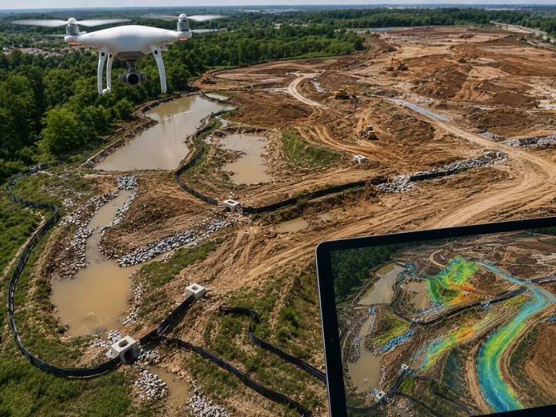
Construction sites change fast. One heavy rain can move soil, redirect water, and wipe out weeks of hard work. That is why erosion control inspection matters so much and why catching problems early makes all the difference. Ground inspections are helpful, but inspectors can only see what they can reach. They often miss early warning signs hidden across large or uneven sites. Drone mapping changes that. It gives project teams a clear view from above, and it can catch developing risks long before anyone walking the ground ever notices them.
How Drone Mapping Reveals Where Water Is Starting to Collect
Water always flows to the lowest point. As a construction site takes shape, even small changes in the ground can send runoff in new directions. Those shifts can quietly cause big problems if no one catches them in time. Drone mapping helps teams spot these patterns before they get out of hand.
When a drone flies over a site, it collects detailed information about the ground’s height and shape. Software then turns that data into a 3D model of the site. That model shows exactly where water is starting to pool or gather. It also highlights low spots and small channels that are hard to see from the ground.
The big win here is timing. Instead of reacting after a drainage problem shows up, teams can fix the grading or add erosion controls before things get worse. Taking action early saves time, money, and soil.
How Drone Mapping Tracks Changes Along Equipment Roads
Heavy trucks and machines are hard on the ground. Over time, all that traffic packs down the soil and breaks up the surface. As a result, roads and pathways that looked solid at the start of a project can slowly become problem areas for erosion.
Drone mapping makes it easy to follow these changes over time. Because crews can fly the same path again and again, they can compare photos and maps from different dates. That side-by-side view quickly shows where ruts have formed, where water flow has changed, or where bare soil has started to grow.
On top of that, this kind of tracking gives site supervisors a clear record of how things looked at each stage. If erosion issues come up later, the map history shows exactly how and when changes happened. That record is useful for managing the project and staying in line with rules and regulations.
How Drone Mapping Finds Uneven Spots Across Busy Work Areas
Active construction zones are always moving and changing. Crews grade and move soil every day, and it is easy for small surface problems to get lost in all that activity. But those small problems like a low spot here, a rough patch there can have a big effect on how water travels across the site.
Drone mapping picks up fine surface details that a ground walk often misses. The maps can show dips that might collect water, areas where the grading is not even, and places where the ground has shifted in ways that were not planned. Plus, those maps are easy to share with the whole team so everyone works from the same information.
Catching these surface issues while they are still small matters a lot. Erosion problems tend to grow quickly once water starts moving through weak spots.
Why Drone Mapping Helps Teams Keep Up With Growing Bare Soil Areas
Every time construction crews clear or dig new ground, more bare soil gets exposed. As the project grows, those bare areas spread across more and more of the site. Because bare soil has no grass or roots to hold it in place, the risk of erosion grows right along with it.
Drone mapping gives project teams a clear picture of how bare soil areas are expanding. By looking at maps from different points in the project, teams can see how much ground has been disturbed and exactly where it sits. That helps them put erosion controls in the right spots at the right time.
Also, drone maps support required project reporting. Many erosion control plans ask for records of how much land has been disturbed. Aerial maps provide a clear, accurate record that is much more reliable than trying to estimate by eye from the ground.
How Repeated Drone Flights Help Teams Spot Site Trends Early
One drone flight gives a single snapshot. A series of flights over time tells the full story. When teams map the site at regular intervals throughout a project, they build a detailed record of how conditions change from week to week. That record is where the real value comes in.
Looking at multiple maps side by side helps teams spot patterns. For example, if the same area keeps showing water pooling after every rain, that is a sign something needs to change with the grading. In the same way, if bare soil keeps spreading past where it should, the maps give clear proof that erosion controls need an update.
Beyond that, tracking trends helps teams spend their time and resources wisely. Instead of checking every corner of a large site equally, project managers can focus on the spots where the data shows risk is growing. That smarter approach leads to better results with less wasted effort.
Frequently Asked Questions
How can drone mapping help identify erosion control risks before traditional inspections?
Drone mapping covers the whole site in a single flight and builds detailed models of the ground’s shape. Those models show drainage patterns, uneven surfaces, and areas of exposed soil that a ground inspector might not reach or notice. Because teams can fly often, they catch small problems early.
What types of site changes are easier to detect with drone mapping than ground inspections?
Drone mapping is great for spotting slow, gradual changes like shifting drainage paths, growing bare soil areas, surface rutting along access roads, and minor dips or uneven spots in the grading. These changes happen little by little and are easy to miss on a walk-through, but they show up clearly when you compare aerial maps over time.
Why is drone mapping useful for monitoring disturbed areas during construction?
Bare soil areas grow as construction moves forward, and keeping track of that growth by hand is hard. Drone mapping gives teams an accurate visual record of how much ground is exposed at any point in the project. That helps with both planning erosion controls and meeting documentation requirements.
Can drone mapping help check changing drainage conditions across a site?
Yes. The elevation models that drones create show where water is starting to concentrate across the site. Teams can use that information to check whether their current drainage controls are working and find spots where changes may be needed before a real problem develops.
How often should drone mapping be done to support erosion control tracking?
It depends on the size of the site, how fast work is moving, and what the weather has been like. That said, many teams fly after major rain events, after big grading pushes, or on a regular schedule like once a week or every two weeks. Flying more often gives a fuller picture of how conditions are shifting and helps teams make faster, better decisions.