↓
 

Tampa Land Surveying

Local Land Surveyors in Tampa, FL

Header image showing Tampa skyline for Tampa Land Surveying website
Tampa Land Surveying
(813) 336-7736
Tampa Land Surveying
  • Home
  • Home
  • ALTA Survey
  • Boundary Surveying
  • Construction Survey
  • Drone LiDAR Mapping
  • Elevation Certificate
  • Land Surveying
  • Topographic Survey
  • About Us
  • Blog
  • Contact Us
Home 1 2 3 … 8 9 >>

Post navigation

← Older posts

Welcome to Tampa Land Surveying

Tampa Land Surveying Posted on August 18, 2017 by TampaSurveyorMarch 20, 2026

Your Final Stop for ALL of Your Survey Needs!                                         Contact us today for a free quote!

This site is intended to provide you with information on Land Surveying in the Tampa, FL and Hillsborough County area of Florida. If you’re looking for a Tampa Land Surveyor, you’ve come to the right place. If you’d rather talk to someone about your land surveying needs, please call our local number at (813) 336-7736 today. For more information, please continue to read.

land surveying
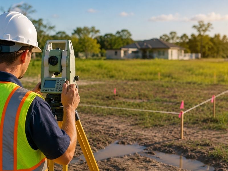
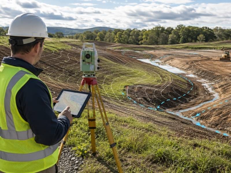
Land Surveyors are professionals who flke precise measurements to determine the size and boundaries of a piece of real estate.  While this is a simplistic definition, boundary surveying is one of the most common types of surveying related to home and land owners. If you fall into the following categories, please click on the appropriate link for more information on that subject:

Tampa Land Surveying services:

    1. I need to know where my property corners or property lines are. (Boundary Survey)
    2. I have a loan closing or re-finance coming up on my home in a subdivision. (Lot Survey)
    3. I need a flp of my property with contour lines to show elevation differences for my architect or engineer. (Topo Survey)
    4. I’ve just been told I’m in a flood zone or I’ve been told I need an elevation certificate in order to obtain flood insurance or prove I don’t need it. (Flood Survey)
    5. I’m purchasing a lot/house in a recorded subdivision. (Lot Survey – See Boundary Survey if you’re not in a subdivision.)
    6. I’m purchasing a larger tract of land, acreage, that hasn’t been subdivided in the past. (Boundary Survey)

Contact Tampa Land Surveying services TODAY at (813) 336-7736.

Posted in boundary surveying, elevation certificate, land surveying, land surveyor | Tagged boundary survey, land surveyor, land surveyor tampa fl, Tampa Land Surveying

Why Boundary Survey Cost Can Increase on Older Properties

Tampa Land Surveying Posted on June 20, 2026 by TampaSurveyorJune 18, 2026
boundary survey cost on older properties showing surveyor working in overgrown land with equipment and property boundary markers

Boundary survey cost can vary from one property to another. Older properties often cost more to survey because they usually require more research and fieldwork. Older deeds, missing markers, changes made over time, and overgrown land can all make the process take longer.

More time and effort usually mean a higher survey cost.

Why Older Properties Often Cost More to Survey

Older properties have a longer history. Before fieldwork begins, a surveyor may need to review many years of deeds and records to understand how the property was originally described and whether any changes were made over time.

Properties that have changed owners many times usually require more research than newer lots with a short ownership history.

Older deeds can also be difficult to interpret. Some descriptions refer to trees, roads, or landmarks that no longer exist. Connecting those old descriptions to today’s conditions takes extra time and can increase the cost of the survey.

Missing Records and Old Deed Language Can Cause Delays

Some older properties have incomplete records. Previous surveys may not have been filed, and older plats may be difficult to find. In some cases, records may even conflict with one another.

Working through these gaps takes time.

Old deed descriptions can also create problems. A deed written many years ago may mention a road that has moved or a creek that has changed course. Surveyors often have to reconstruct these old references to determine the correct boundary.

The extra research involved can add to the total survey cost.

How Property Changes Affect a Boundary Survey

Over the years, many owners may have made changes to the property. Fences may have been moved, sheds may have been built, and driveways may have changed locations.

Surveyors must document these features when establishing the legal boundary.

The problem is that many of these changes were never recorded. A fence built decades ago may not follow the true property line. Surveyors must determine whether these features match the legal records or were simply placed based on estimates.

Sorting through years of changes takes more time and increases the cost of the survey.

Land Conditions That Can Increase Survey Costs

Older properties are often overgrown. Thick trees, brush, and weeds can block the clear lines that surveyors need to take accurate measurements.

Before measurements can be made, the survey crew may need to work around or through heavy vegetation.

Newer properties in developed neighborhoods usually have fewer obstacles. On older rural properties, however, thick growth can slow down work at every corner.

More time in the field means higher survey costs.

Ways to Help Reduce Survey Costs

Property owners can take a few simple steps to help speed up the process.

Sharing old surveys, deeds, title documents, and plat maps with the surveyor can make research easier. Even older records may provide useful information and reduce the time spent searching for documents.

If you know where old property pins or corner markers are located, tell the surveyor before work begins. Markers from surveys completed many years ago may still be in the ground.

Clearing brush and creating access paths along the property lines can also help the survey crew work more efficiently and reduce the amount of time spent in the field.

Frequently Asked Questions

Why do older properties cost more to survey?

Older properties often have longer ownership histories, older deeds, and incomplete records. Surveyors need more time to research and verify the boundary, which increases the overall cost.

Can missing markers increase the cost of a boundary survey?

Yes. If corner markers are missing, surveyors must re-establish their locations using deeds, plats, and measurements from nearby markers. This process takes more time and can increase the cost.

Do property changes affect survey costs?

Yes. Fences, sheds, driveways, and other improvements added over the years can make the survey more complicated. Surveyors must document these features and determine whether they match the legal boundary.

Can overgrown land make a survey take longer?

Yes. Thick trees and brush can block the lines needed for accurate measurements. Extra time spent working through heavy vegetation can increase the overall cost of the survey.

How can I prepare my property for a survey?

You can help by providing old deeds, surveys, title documents, and plat maps. If you know where old property markers are located, share that information with the surveyor. Clearing brush and creating access paths along the property lines can also help speed up the work.

Posted in boundary surveying | Tagged boundary survey

What an As-Built Survey Shows After a Pool or Home Addition Is Finished

Tampa Land Surveying Posted on June 19, 2026 by TampaSurveyorJune 18, 2026
as-built survey after pool or home addition showing surveyor checking property survey cost and site measurements in backyard

An as-built survey is completed after construction is finished. It shows the final size, location, and layout of structures and improvements as they were actually built. When a homeowner adds a pool, room, garage, or porch, an as-built survey creates an official record of the completed work and where it sits on the property.

This record is important for permits, inspections, and keeping property records up to date.

What Are As-Built Surveys and Why Do They Matter?

An as-built survey shows the finished condition of a property after construction. It shows where new structures are located, how large they are, and how they relate to property lines and other features on the lot.

Unlike building plans, which show what was intended, an as-built survey shows what was actually built.

This matters because construction does not always follow the original plans exactly. A pool may end up a few feet from its planned location. A room addition may be slightly larger than expected. An as-built survey records the final result and becomes part of the property’s history.

What an As-Built Survey Shows After a Pool Is Finished

After a pool project is complete, an as-built survey shows the exact location of the pool on the property. It measures how far the pool sits from the house, property lines, and other nearby structures.

The survey may also show:

  • Pool decking
  • Equipment pads
  • Fencing
  • Drainage improvements

This information is important because many building departments require an as-built survey before closing a pool permit. The survey confirms that the pool meets setback requirements and does not extend into a neighboring property or an easement.

Having the survey ready can help speed up the final inspection and permit close-out.

How As-Built Surveys Document Home Additions

A home addition changes the size and layout of a property. When a new room, garage, or porch is added, the home no longer looks the same as it did before construction.

An as-built survey shows the completed addition and its exact location in relation to the property lines.

This updated record is important because building departments may require it to confirm that the addition meets setback requirements. Lenders and title companies may also request a current survey when a property is sold or refinanced.

An as-built survey gives everyone an accurate picture of the property after the work is complete.

Why Accurate Measurements Matter

Building plans show what a project is supposed to look like before construction begins. An as-built survey shows what the finished project actually looks like.

The two do not always match. Walls may shift slightly, and site conditions can affect the final layout. Changes in grading can also affect how features sit on the land.

Accurate measurements matter because future projects depend on knowing what is already there. If a homeowner later wants to add a fence, widen a driveway, or apply for another permit, updated records can save time and prevent problems.

Clear records give contractors and designers a reliable starting point for future work.

When to Get an As-Built Survey

The best time to get an as-built survey is soon after construction is finished. At that point, the completed structures are easy to measure, and any questions about their final location can still be addressed.

Waiting too long can make some details harder to verify, especially if landscaping or other improvements cover parts of the site.

In many cases, a building department requires an as-built survey before scheduling the final inspection. Contractors, homeowners, and local agencies use the survey to confirm that the project was built according to the approved plans.

Getting the survey done right away helps keep the permit process moving and creates an accurate record before future projects begin.

Frequently Asked Questions

What information is included in an as-built survey?

An as-built survey shows the final size, location, and layout of completed structures and improvements. It may include buildings, pools, decking, fences, and grading changes.

Can as-built surveys be used for both pools and home additions?

Yes. As-built surveys can document many types of completed construction. They can show a new pool, a room addition, a detached garage, or several improvements completed during the same project.

How are as-built surveys different from building plans?

Building plans show how a project was designed before construction began. An as-built survey shows what was actually built after the work was completed. It reflects the final condition of the property.

Who may ask for an as-built survey?

Building departments often require one to close out a permit. Lenders and title companies may also request one when a property with recent improvements is sold or refinanced. Homeowners use them to keep their records current.

Can as-built surveys help with future remodeling projects?

Yes. An as-built survey gives contractors and designers accurate information about existing structures. This helps with planning future work, avoiding conflicts, and making sure new projects meet setback requirements. Starting with accurate records can save time and reduce problems during construction.

Posted in construction | Tagged construction survey

Can an Old Property Survey Affect Property Survey Cost Today?

Tampa Land Surveying Posted on June 18, 2026 by TampaSurveyorJune 18, 2026
old property survey affects property survey cost today by helping surveyor check boundary records and corner markers

Property survey cost depends on many things, and one of them is whether an old survey already exists for the property. When a homeowner has an older survey on file, it may give the surveyor a head start on research. That head start can save time, and time saved can affect the final cost. But not every old survey helps. Some are too outdated to be useful, and others may actually create more work if the records no longer match conditions on the ground.

Can an Old Survey Help Lower Property Survey Cost?

An old survey gives a new surveyor something to start from. It shows the boundary lines, corner marker locations, and site features that existed when the survey was done. If those records are still accurate and the corner markers are still in place, the surveyor spends less time on research and fieldwork to confirm what is already documented.

Less research time and faster fieldwork can reduce property survey cost. A surveyor who finds solid prior records may not need to pull as many documents or spend as much time tracking down boundary evidence. That savings does not always show up in a lower quote, since other factors also affect pricing, but having a usable old survey on file is generally better than starting from nothing.

Signs That an Old Survey May No Longer Be Useful

An old survey loses its value when the property no longer matches what the document shows. New structures built after the survey date, fences moved or added, and changes to driveways or site features all create gaps between the old drawing and current conditions. When those gaps are large, the surveyor has to collect new data to fill them in, which adds time and cost.

Missing corner markers are another sign that an old survey may not help much. If the markers shown on the old drawing are gone from the ground, the surveyor has to find or replace them using other methods. That process takes more time than simply confirming a marker that is already in place. The older the survey and the more the property has changed, the less the old document can reduce the work involved in a new one.

Why Surveyors Still Check Old Survey Records

Even when an old survey is outdated, surveyors still look at it. An old survey shows what the boundary was understood to be at a past point in time. That context helps the surveyor understand the history of the property and spot anything that may have changed or shifted over the years.

Checking old records is part of doing the job correctly, not a shortcut. A surveyor does not copy an old survey and hand it back as a new one. They use it as one piece of evidence alongside deeds, plats, and physical markers on the ground. When the old survey matches current conditions, it speeds things up. When it does not, it still provides a useful background that helps the surveyor understand the full picture before making any decisions about the boundary.

Other Things That Can Affect Property Survey Cost

The age of an existing survey is just one factor. Property size plays a big role too. A larger lot takes more time to measure than a smaller one, which raises the cost. Lot shape also matters. A simple rectangular lot is faster to survey than one with many corners, curves, or irregular edges that require more measurements to document accurately.

The type of survey needed affects cost as well. A basic boundary survey costs less than a full plat of survey that documents all existing site features and gets recorded with a local office. Heavily wooded lots, lots with limited access, and properties near water or other difficult terrain also tend to cost more because fieldwork takes longer. Property survey cost reflects the total amount of time and work the job requires, not just one single factor.

How to Get Ready for a New Survey

Homeowners can help the process go more smoothly by gathering any property documents they already have before the surveyor starts work. Old surveys, deeds, plat maps, and title documents all give the surveyor useful background on the property. Even an old survey that is no longer fully accurate can help by showing what the boundary looked like in the past.

Knowing where existing property corner markers are located is also helpful. If a homeowner can point out stakes, iron pins, or concrete monuments at the corners of the lot, the surveyor can confirm them faster than searching from scratch. Sharing any documents or information about recent changes to the property, such as new fences or additions, also helps the surveyor understand what to look for when they arrive on site.

Frequently Asked Questions

How old is too old for a property survey?

There is no set age that makes a survey automatically too old to use. What matters is whether the property has changed since the survey was done and whether the corner markers it shows are still in place. A survey from twenty years ago may still be useful if nothing on the property has changed. A survey from five years ago may already be outdated if major improvements were made after it was completed.

Can changes to my property increase the cost of a survey?

Yes. Additions, new fences, outbuildings, and other changes made after the last survey mean the surveyor has to document more than the old records show. That extra work adds time, and more time generally means a higher cost. The more the current property differs from the old survey, the more new fieldwork the surveyor has to do.

Will a missing property marker affect the survey process?

Yes. When a corner marker shown on an old survey is no longer on the ground, the surveyor has to locate or re-establish it using deed records, plat data, and measurements from other markers. That takes more time than confirming a marker that is already in place, which can add to the overall cost and time needed to complete the survey.

Can I give my surveyor a copy of an old survey?

Yes, and it is a good idea to do so. An old survey gives the surveyor background on the property’s boundary history and the location of prior corner markers. Even if the old survey is outdated, it still helps the surveyor understand what the property looked like at a past point in time, which is useful context for the new work.

Does every property need a new survey?

Not always. Whether a new survey is needed depends on the purpose and whether older records are still accurate. If a homeowner needs a survey for a specific project, permit, or transaction, the requirements of that process usually determine whether a new one is needed. A licensed surveyor can review the existing documents and advise whether they are sufficient or whether new fieldwork is required.

Posted in boundary surveying | Tagged boundary survey

Post navigation

← Older posts
Get Quote Button
© Tampa Land Surveying
Tampa, Florida
Phone: (813) 336-7736

Web Development and SEO by:
N2Biz.co


Privacy Policy | Terms of Use

The owner of this website, USA Surveying & Engineering, LLC., provides coordination of professional land surveying and engineering services in all 50 states. The professional surveying and engineering services provided to you will be conducted by fully licensed professionals in your state.

Privacy Policy
↑