
When Survey Mapping Helps Prevent Drainage Problems
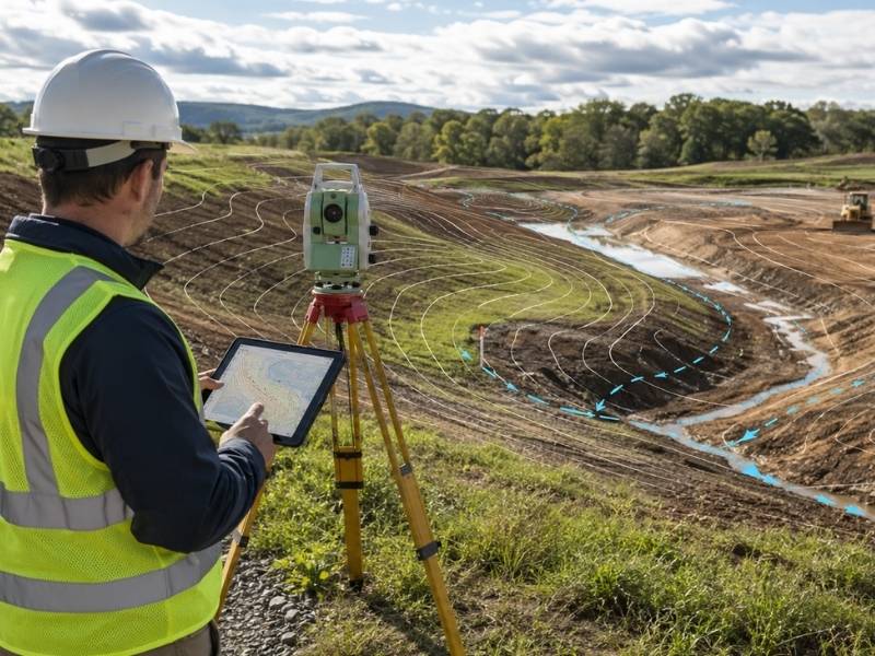
Survey mapping can catch a drainage problem years before it floods a foundation. Developers often think of drainage as something to fix after water starts pooling. That’s backwards. Good survey mapping spots the warning signs while the site is still just dirt and a plan on paper.
That is why a grading plan review should start with accurate survey mapping, not after drainage issues appear during construction.
Here’s how survey mapping helps prevent drainage trouble, and what to look for before you build.
How Surface Flow Patterns Appear Before Water Reaches Structures
Water moves across land in predictable ways, following the slope of the ground. Survey mapping captures this flow pattern before construction changes it. That data shows exactly where water travels during rain, long before a single structure goes up.
This matters because once buildings, driveways, and hardscape are in place, changing the flow pattern gets expensive fast. Catching a problem flow path on the map, while it’s still just open land, costs far less to fix.
What to do:
- Ask your surveyor to map surface flow direction across the whole site, not just the building pad.
- Compare flow patterns against your planned structure locations before finalizing the site layout.
- Flag any flow path that crosses where a building or driveway is planned.
Why Slight Grade Reversals Can Create Hidden Ponding Areas
A grade reversal happens when the land dips slightly in a spot where it should be sloping away. These reversals are often small, sometimes just a few inches, and easy to miss without detailed mapping. But water doesn’t care how small the dip is. It settles wherever the ground lets it.
Hidden ponding areas caused by grade reversals often don’t show up until after a heavy rain, when standing water appears somewhere nobody expected. Survey mapping catches these dips before they become a surprise puddle next to a building.
What to do:
- Request detailed elevation mapping that can catch small grade reversals, not just major slopes.
- Review the map for any low spot near a planned structure or hardscape area.
- Correct identified reversals during grading, before construction locks the shape of the land in place.
How Survey Mapping Reveals Drainage Conflicts Between Lots
Water doesn’t respect property lines. A lot that slopes toward a neighbor can send runoff onto that neighbor’s land, and a lot that receives runoff from an uphill neighbor needs to be designed to handle it. Survey mapping shows these relationships clearly, using elevation data from both the site and the surrounding area.
Skipping this step can mean designing a site plan that either creates a runoff problem for a neighbor or gets overwhelmed by water flowing in from next door. Neither outcome is cheap to fix after construction.
What to do:
- Get mapping data that extends slightly beyond your property line, not just the lot itself.
- Check how your site’s drainage plan interacts with neighboring lots before finalizing grading.
- Review local drainage rules that may apply when runoff crosses a property boundary.
Why Existing Swales and Ditches Need Accurate Field Location
Swales and ditches often already exist on a site, sometimes from years ago, sometimes as part of a broader drainage system for the area. These features need to be located accurately, not estimated, because their exact position affects how much they can actually handle during heavy rain.
A swale that’s mapped incorrectly can end up too close to a planned structure, or worse, get filled in by accident during grading because nobody realized it was doing important work.
What to do:
- Have existing swales and ditches field located and included in the survey map, not just noted generally.
- Confirm which swales are part of a larger municipal or community drainage system before altering them.
- Avoid grading over or filling in any swale without confirming it’s no longer needed.
How Mapped Elevation Data Helps Prevent Costly Regrading Mistakes
Elevation data from survey mapping gives a grading plan something to measure against. Without it, grading decisions rely on visual judgment, which is far less reliable than it sounds, especially across a large site with subtle elevation changes.
Mapped elevation data lets a grading crew work from actual numbers instead of guesses. That reduces the chance of creating a new drainage problem while trying to fix an old one, which happens more often than most developers expect.
What to do:
- Use mapped elevation data as the baseline for every grading decision, not visual estimation.
- Recheck elevations after grading work to confirm the site matches the planned drainage design.
- Keep the original survey map on file to compare against future site changes.
What This Means for Your Next Site Plan
Survey mapping gives a development project the data it needs to prevent drainage problems before they start. Surface flow patterns, grade reversals, lot to lot conflicts, existing swales, and accurate elevation data all play a part. Map the site thoroughly before design work begins, and use that data to guide every grading decision that follows. It costs far less than fixing a flooded foundation after the fact.
Frequently Asked Questions
How is survey mapping for drainage different from a standard boundary survey?
A boundary survey confirms property lines, while drainage-focused survey mapping captures elevation, slope, and surface flow data needed to understand how water moves across a site.
Can survey mapping predict how a site will handle a major storm?
It provides the elevation and flow data needed for that type of analysis, although predicting storm response usually requires a separate engineering study based on the mapping data.
How often should drainage-related survey mapping be updated on an active development site?
Many developers update it after major grading changes or construction phases because altered elevations can shift how water moves compared to the original map.
Do local governments require drainage mapping data before approving a site plan?
Requirements vary by jurisdiction, but many local governments request elevation or drainage data as part of site plan review, especially for larger developments.
Can a small grade reversal really cause a significant drainage problem?
Yes. Even a shallow dip can collect enough water to cause pooling or soil saturation issues, especially in areas with heavy rainfall or a high water table.