
How an Elevation Certificate Can Lower Your Flood Insurance
Flood insurance is one of the biggest recurring costs developers face on low-lying or coastal properties. And most people paying those premiums have no idea they might be overpaying.
An elevation certificate can change that. It’s a document that tells your insurance provider exactly how high your building sits relative to the base flood elevation in your area. When your structure sits higher than that line, your risk goes down. And when your risk goes down, your premium should too.
This article breaks down how the process works, what the certificate actually measures, and why getting one done early can save real money on flood insurance costs across a development portfolio.
What Is an Elevation Certificate?
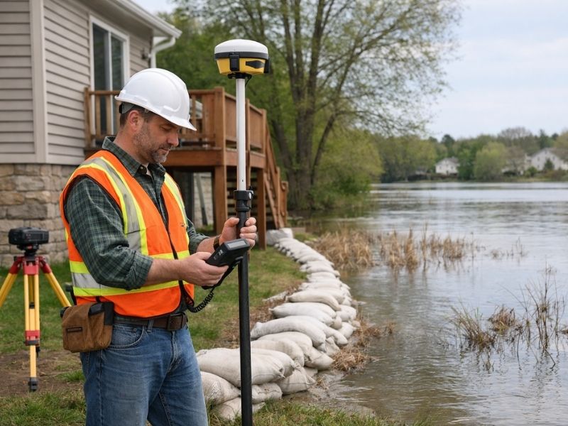
An elevation certificate is an official document completed by a licensed land surveyor. It records the elevation of a structure and compares that number to the base flood elevation (BFE) assigned to that property by FEMA flood maps.
The BFE is the elevation that floodwater is expected to reach during a major flood event. If your building sits above that line, you’re at lower risk. If it sits below, you’re at higher risk and paying higher premiums to match.
The certificate captures several specific measurements:
- The lowest floor elevation of the structure
- The elevation of attached garages or enclosures
- The lowest adjacent grade around the building
- The flood zone designation for the property
Insurance providers use these numbers directly when calculating your National Flood Insurance Program (NFIP) rate. Without a certificate, they often assign a default rate based on estimated risk, and that default is almost never in your favor.
How an Elevation Certificate Can Lower Your Flood Insurance Premiums
The connection between the certificate and your premium is straightforward. NFIP rates are tied to how many feet above or below the BFE your lowest floor sits.
Each foot above the BFE typically reduces the annual premium by a meaningful amount. Properties sitting two or three feet above the BFE can see dramatically lower rates than properties at or below it.
Here’s the problem many developers run into: FEMA flood maps don’t always reflect actual site conditions. A parcel may appear to sit in a high-risk zone on a map, but a proper elevation survey shows the finished floor is well above the BFE. Without the certificate, the insurance company has no reason to price it that way.
The certificate is the proof. It gives the insurer the verified numbers needed to apply the correct rate.
Why Default Rates Are Usually Too High
When no elevation certificate exists, insurers use a process called “preferred risk” or standard zone pricing based on the map alone. That’s a blanket estimate. It doesn’t account for actual site grading, finished floor elevation, or any site-specific conditions that reduce real exposure.
For developers with multiple properties or units, that gap between the default rate and the certified rate can add up fast across an entire portfolio.
When Developers Should Get an Elevation Certificate
Timing matters. Getting the certificate after a project is built is better than never getting one. Getting it before construction decisions are finalized is better still.
There are three points in a project where the certificate has the most value.
The first is during site evaluation. If a parcel is mapped in a flood zone, a preliminary elevation analysis helps determine whether the project can be designed to clear the BFE with minimal cost. Raising a finished floor by one foot during design is cheap. Raising it after a slab is poured is not.
The second is at permit stage. Many jurisdictions require an elevation certificate as part of the permit application for new construction in flood zones. Having it ready avoids delays.
The third is at closing or lease-up. When units are sold or rented, buyers and lenders often request the certificate. It also gives future owners the documentation they need to keep their insurance rates accurate.
What Happens Without One at Closing
Buyers who don’t receive an elevation certificate at closing sometimes discover the issue when they go to obtain flood insurance. At that point, they either pay a default rate or commission a new survey themselves. Neither outcome reflects well on the developer.
The Link Between Elevation Certificates and LOMA Requests
Some properties mapped in flood zones shouldn’t be there at all. If a survey shows a structure or parcel sits entirely above the BFE, the owner may qualify for a Letter of Map Amendment (LOMA).
A LOMA is a formal request to FEMA to remove a property from the flood zone designation. An approved LOMA can eliminate the federal requirement to carry flood insurance entirely on properties with federally backed mortgages.
The elevation certificate is the primary supporting document for a LOMA request. Without accurate elevation data from a licensed surveyor, FEMA won’t process the amendment.
This is a separate topic from general premium reduction, but it’s worth knowing the two processes are connected. The same certificate that reduces premiums can also serve as the foundation for removing the flood insurance requirement altogether.
What to Expect From the Survey Process
A licensed surveyor visits the site and collects the elevation measurements listed above. They compare those numbers against the current FEMA Flood Insurance Rate Map (FIRM) for the area and complete the official FEMA Elevation Certificate form.
The completed certificate is signed and sealed by the surveyor, which gives it the legal weight insurance companies and lenders require.
Turnaround time varies by surveyor and workload, but most projects complete within a few weeks of the site visit. For developers working against a permit or closing deadline, it’s worth scheduling the survey early rather than treating it as a last-minute item.
Frequently Asked Questions
Can an elevation certificate guarantee a lower flood insurance premium?
No certificate guarantees a specific outcome, but if the measured elevations come in above the base flood elevation, the NFIP rate structure will reflect that. The certificate gives the insurer verified data to work from instead of estimates.
Does an elevation certificate expire?
The certificate itself doesn’t expire, but it may become outdated if FEMA remaps the flood zone or if the property is altered. Lenders and insurers sometimes request updated certificates after major FIRM revisions.
Who completes an elevation certificate?
Only a licensed land surveyor, engineer, or architect authorized by the state can complete and certify an elevation certificate. A contractor or general inspector can’t produce one with legal standing.
Can I use an old elevation certificate from a previous owner?
Sometimes. If the structure hasn’t changed and the flood maps haven’t been revised since the certificate was completed, it may still be valid. A licensed surveyor can review it and advise whether a new one is needed.
Is an elevation certificate required for all flood insurance policies?
Not always. Some lower-risk zones use simplified rating methods that don’t require one. For properties in high-risk zones (AE, VE and similar designations), the certificate is typically required or strongly recommended to get accurate pricing.