
Preparing a Public Pier Replacement With a Topographic Survey
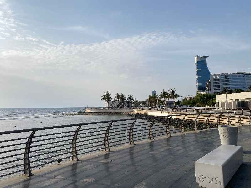
A topographic survey gives that whole team the same starting point, with mapped elevations, shoreline features, drainage paths, and access routes in one drawing. Order it early in planning, and expect it to shape everything from deck height to the staging plan. Municipal project managers, parks departments, and port authorities usually lead these projects. Coastal engineers, marine contractors, and permitting consultants work alongside them.
Public piers take a beating. Salt air, storm surge, boat wakes, and years of foot traffic wear down pilings, decking, and the ground where the pier meets land. When a city or county decides it’s time to replace one, the design team needs an accurate picture of the site before anyone draws a new structure.
Assessing Existing Shoreline Conditions Before Pier Replacement
Shoreline conditions tell designers what the new pier has to connect to. The survey crew maps seawalls, bulkheads, riprap, beaches, vegetation lines, and any eroded areas near the pier. They also locate old pilings, abutments, and remnants of earlier structures that could get in the way of new construction.
Tidal lines often matter on these projects. Many waterfront jobs need the mean high water line or another tidal boundary shown on the drawings, since it can affect ownership limits and permitting. The method and standard for locating that line can vary by state and agency, so ask your surveyor what your project requires before field work starts.
Keep in mind that a land-based survey doesn’t measure the bottom under the water. Water depths and seabed conditions come from a separate bathymetric or hydrographic survey. Many pier projects combine both so designers can see a continuous surface from the parking lot to the end of the pier.
Mapping Ground Elevations and Waterfront Access Points
Elevations show how the land rises and falls across the site. Surveyors measure spot heights and create contour lines, which connect points of equal elevation, so designers can see slopes at a glance. On pier projects, the most important areas are usually the approach, the landing where the pier meets land, and the paths people use to reach the water.
Public piers draw a lot of visitors, and access has to work for everyone. Walkways, ramps, parking areas, restrooms, and fishing or kayak launch points all need mapped elevations. Those details help engineers design accessible routes that meet the standards the project must follow. Which standards apply can vary by agency and funding source, so confirm them with your engineer.
Ask the surveyor to tie elevations to the vertical datum your design team plans to use. Coastal projects often compare land elevations, tidal datums, and flood elevations side by side. A mismatch between datums can throw off deck heights by more than a foot, and that mistake is easy to make and costly to fix.
Identifying Drainage Patterns and Coastal Site Constraints
Drainage on a waterfront site usually heads toward the water, sometimes faster than anyone expects. The survey shows where runoff collects, where it flows across walkways, and where it spills over the shoreline. Low spots near the pier landing can cause standing water, erosion, or slippery surfaces for visitors.
The crew also maps stormwater inlets, outfall pipes, and swales that drain upland areas into the water. These features may need protection or relocation during construction. Utilities matter too. Lighting, water service for fish-cleaning stations, and electrical lines often run toward the pier and need to be located before design begins.
Coastal constraints extend beyond drainage. Mangroves, seagrass areas, dunes, and protected habitat can limit where crews work and what equipment they use. A surveyor can locate the edges of these features once a biologist or environmental consultant flags them. Flood zone information also affects design, so check the current flood maps that apply to the site.
Using Topographic Survey Data for Pier Design and Construction Planning
Engineers use topo data to set the new pier’s alignment, length, and deck elevation. The ground surface at the landing controls how the pier transitions from land to structure. Mapped tidal and flood elevations help designers set a deck height that suits current conditions and the project’s design criteria.
Construction planning depends on the same data. Contractors look at slopes, open areas, and access routes to plan demolition, crane placement, material delivery, and staging. On tight waterfront sites, a barge may handle much of the work, while land-based equipment uses the upland area. Accurate elevations and site features help the contractor decide what will fit.
What to Ask Your Survey Team
- Which areas, utilities, and features will appear on the drawing
- Which horizontal and vertical datums will be used
- Whether tidal lines or bathymetric data are part of the scope
- What file formats your engineer needs for design software
Clear answers up front keep the survey from coming back incomplete.
Coordinating Survey Findings With Permitting and Site Preparation
Waterfront permitting often involves more than one agency. Local, state, and federal reviewers may each look at the plans, depending on the location and the work involved. Permit applications commonly need drawings that show existing conditions, shoreline features, and the proposed structure. Survey data gives those drawings a reliable base.
Timing matters. Permit reviews on coastal projects can take a while, and missing information can restart the clock. Confirm what each agency expects before the survey is finalized, so the drawings include the right features and labels the first time.
Site preparation follows the permits. Survey control points, which are fixed reference points with known coordinates, should be protected so the construction team can use them later. The surveyor can also stake work limits, protected habitat edges, and utility locations before demolition starts. That step keeps crews inside the approved footprint.
Frequently Asked Questions
What does a topographic survey show for a pier project?
It shows ground elevations, contour lines, and visible features on the land side of the site. That often includes seawalls, walkways, parking, utilities, drainage structures, and vegetation lines. The survey may also show the existing pier and any old pilings. Underwater depths usually require a separate bathymetric survey.
Do pier replacements need a tidal boundary survey?
Many waterfront projects need a tidal line shown on the drawings. It can matter for ownership limits, permits, and design. The rules for locating it vary by state, agency, and project type. Ask your surveyor and permitting consultant early so the requirement is in the scope.
How long does survey work take for a public pier?
Timing depends on the site size, tidal conditions, and the features that need mapping. Adding bathymetric or tidal work can extend the schedule. Weather and tides can also limit when crews can safely work near the water. Order the survey early if design or permitting dates depend on it.