
House Survey Planning for Homes Beside a Stormwater Project
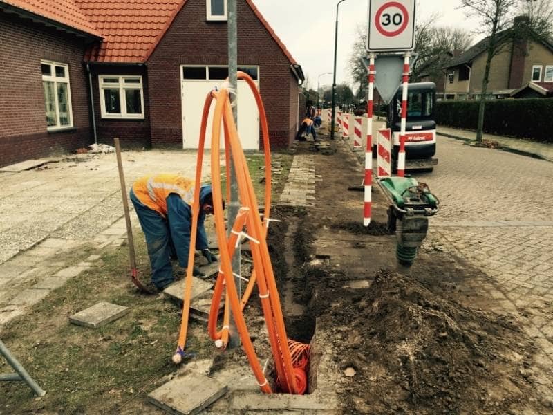
A crew shows up down the street with heavy equipment. The city or a developer is building a stormwater project, maybe a new pond, pipe, or drainage channel. Your home sits right beside it, and now you wonder how the work will affect your land. Projects like these often involve utility planning as well, since new drainage systems, access areas, and underground infrastructure can change how nearby properties are used and maintained.
A house survey helps answer that. It records your property as it stands before the project changes anything nearby. Without that record, you have no clear proof of your lines, grades, or drainage before the work starts. If problems show up later, that missing baseline can cost you.
Here is the takeaway. A house survey documents your property and its drainage before a stormwater project changes the area. That record becomes valuable project documentation by showing existing conditions, protecting your lines, your grades, and your peace of mind. The sections below explain what to check and why it matters.
Reviewing Existing Conditions Near Stormwater Improvements
A house survey records your property lines, your home, and the features around it. It shows where your lot ends, where the house sits, and how the ground is shaped. Near a stormwater project, that snapshot of current conditions is worth having. Site assessment services can help document these existing conditions and provide a clearer understanding of how nearby improvements may affect your property before changes begin.
Stormwater projects change how water moves through an area. A new pond or channel can shift drainage patterns on nearby lots. Knowing your conditions before the work starts gives you a point of comparison. If your yard drains differently later, you can show how it looked before.
Start by getting a clear picture of your property today. A licensed surveyor can map your lines, grades, and drainage features. That record sets a baseline you can rely on. It also helps you spot any issue early, while it is still easy to address.
Documenting Property Features Before Project Changes
Details matter when a big project moves in next door. A house survey captures the features on your lot in accurate positions. That documentation protects you if anything shifts once construction begins.
A good survey records more than just your boundary. It maps the parts of your property that a project could affect:
- Property lines and corners
- The house and any additions
- Driveways, patios, and walkways
- Fences and retaining walls
- Existing drainage paths and low spots
Having these on record is a real safeguard. If a fence or driveway later seems out of place, the survey shows where things stood before. It also helps confirm that the project stayed off your land. Easement and right-of-way details often come into play near public projects, so a survey helps clarify those too.
Evaluating Drainage Impacts Around Residential Sites
Drainage is the biggest concern for homes beside a stormwater project. The whole point of such a project is to move water, and that can change how water reaches your lot. A survey helps you understand your drainage before and after.
A survey with elevation data shows how your land sits. It reveals low spots, slopes, and where water flows across your yard. On flat Florida lots, small grade changes decide whether water drains or pools. That detail helps you see how a nearby project might affect you.
This information is useful if a dispute ever comes up. Say your yard starts flooding after the project finishes. A survey showing your original grades and drainage gives you facts to work from. Drainage rules and responsibilities can vary by county, city, and project, so confirm how the project may affect you early.
Coordinating Home Planning With Accurate Survey Information
Many owners plan their own improvements around the same time. Maybe you want a new fence, a shed, or a raised garden after the project settles. A house survey helps you plan those with accurate information.
The survey shows your true lines and grades. That keeps your own projects on your land and clear of easements. It also helps you plan around any new drainage features next door. Building without that data risks a costly mistake.
Timing helps here too. If the stormwater project affects your access or grades, you want to know before you build. A survey lets you plan with the changes in mind. Permit rules for home improvements can vary by city and county, so confirm them before you start.
Reducing Property Risks Near Stormwater Projects
A large project next door brings real risk to nearby homes. Drainage can shift, lines can blur, and disputes can follow. A house survey lowers that risk with a clear record.
The survey protects you in plain ways. It documents your property before the work begins. It gives you proof of your lines and grades. It provides facts if you ever question the project’s effect on your land.
Treat the survey as an early step, not a reaction after problems appear. Order it before or early in the nearby project, while your conditions are still original. If a concern or a home project depends on it, book the survey soon. That record can save you stress and money down the road.